Table of Contents
The following general frameworks describe different approaches for local communities as they balance planning for hazards with other important land use goals.
- Prevent development in hazardous areas. An obvious solution for making communities safer is to avoid hazardous areas altogether, as discussed in the sidebar below. Communities can discourage or restrict development in vulnerable areas such as floodplains, landslide areas, the wildland-urban interface (WUI), or other known hazard areas. Avoiding hazardous areas can be accomplished through regulations (such as overlay zoning) or through incentives (such as cluster subdivisions). There are also non-regulatory approaches, such as land acquisition.
- Direct future growth to safer areas. Preventing development in hazardous locations is only part of the equation. Communities can also encourage growth in locations that are less vulnerable to natural hazards. Directing future growth requires that the community identify locations deemed suitable for development and redevelopment. This process often forms the core of future land use elements in comprehensive plans. Once safe areas have been identified, communities can back up those policy decisions by directing investment (such as capital improvements and schools) and removing barriers to developing in those areas.
- Protect existing development in hazardous areas. Avoiding hazard areas protects future development; however, protecting people, property, and facilities in already-developed areas is just as important. Strengthening existing development can be achieved through many land use and mitigation strategies, such as upgrading development standards to protect vulnerable areas (e.g., stronger floodplain regulations), requiring nonconforming properties to be brought into compliance with updated standards, updating building codes to promote safer development, and in some cases relocating existing structures to less-vulnerable areas.
Each of these approaches provides possible solutions for Colorado communities looking to plan for or protect development from hazard risk. Most likely, a community will embrace a set of complementary approaches based on local circumstances. There are not necessarily bright lines between the approaches. Indeed, there is some overlap, and many of the planning tools profiled in this guide may be used to support more than one objective. For example, a land acquisition strategy could be used to both restrict development in hazard-prone areas and also shift development to safer locations. The approaches should be evaluated for their potential effectiveness, and subsequent regulatory tools tailored to meet local needs.
Avoidance
The most effective way to protect development from hazards is simply to prohibit development in known hazard areas.
However, strictly prohibiting development in any area with a potential hazard can be not only logistically challenging, but often politically infeasible. Nevertheless, many of the tools and strategies discussed in this guide are designed to keep development out of harm’s way through avoidance. They include:
- Transfer of development rights
- Cluster subdivision
- Conservation easement
- Land acquisition
- Overlay zoning
- Stream buffers and setbacks
- Subdivision and site design standards
- Post-disaster building moratorium
Natural hazards, like much of nature, are part of an interconnected, complex system. While most hazard events seemingly occur independently, they are often correlated and in some cases may greatly influence the probability, frequency, and magnitude of one another. This can be true even when specific hazard occurrences are separated by long distances or periods in time.
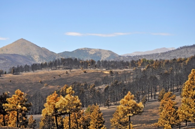 The interrelatedness of natural hazards is particularly evident in Colorado’s semi-arid climate. As described in the Colorado Resiliency Framework (2015), three of the most significant hazards of concern in the state are linked together in what has been referred to as the “drought/fire/flood system” (p. 3-7). In this system, the reduced water and moisture availability in a drought increases risks related to wildfire through higher fuel loads (drier conditions, pest infestation, tree mortality, etc.). Severe wildfires can then leave slopes denuded of all vegetation and turn soils into hydrophobic surfaces, preventing rainfall from being absorbed into the ground and in turn rapidly increasing the amount of runoff from heavy rain events. These conditions drastically increase risks related to flash flooding, erosion, and mud/debris flows. As the pattern of these cascading natural hazards suggests, some of Colorado’s most destructive flash flood events can ironically be linked to previous incidents of drought. Many of Colorado’s past disaster events provide clear evidence of these direct relationships between drought, wildfire, and flood, including a recent series of destructive floods in the burn scar areas surrounding Colorado Springs.
While drought, wildfire, and flood hazards are more discernibly related, they are part of the same natural system with direct or indirect relationships to the risk levels for other hazards including extreme heat, severe winds, lightning, soil hazards, landslides, mud/debris flows, and rockfalls. Further, as described in the next section, the projected long-term effects of climate change are expected to influence the risk levels for most natural hazards in Colorado.
The climate in Colorado is changing, in large part due to increasing levels of greenhouse gases (GHGs) in the atmosphere. The state is significantly warmer today compared to 50 years ago, with the average annual temperature having increased 2.5 degrees Fahrenheit since 1965. Scientists estimate that the state will see an additional 2.5 to 5 degrees of warming by 2050 (Colorado Climate Plan, 2015). Already, past warming in Colorado has resulted in multiple hazards including faster and earlier snowmelt, longer and more severe droughts, and more frequent periods of extreme heat. Moving forward, climate change is expected to have significant impacts across multiple sectors of our state’s economy.
Climate Change in Colorado –
An Interview with Taryn Finnessey
The climate in Colorado is changing, with important implications for local communities. To learn more about the science of climate change in Colorado, the project team interviewed Taryn Finnessey, Climate Change and Risk Management Specialist at the Colorado Water Conservation Board (CWCB).
Q: What is the climate change outlook for Colorado?
Temperatures in Colorado have risen, and we are anticipating an additional 2.5 degrees of warming by mid-century. Warming is really the driver that affects water availability, soil moisture, and evapotranspiration. All of those play a role in fire hazard, drought, and ecosystem and watershed health. Temperature has an impact on floods, both post-fire and post-drought. There are public health implications as a result of increased temperature and impacts on water quality and air quality.
Precipitation is a bit harder to pin down. Some models show precipitation increasing, some show it decreasing. Should we see a decrease in precipitation, it will further compound many of these issues. Even if precipitation stays the same, we will see a decrease in water availability because it will take incrementally more precipitation to overcome that warming signal.
Q: What other impacts should we expect to see from the changing climate?
One of the things we will see is an increase in water temperatures, which is obviously a concern for our cold-water fish species. We are also seeing a shift in earlier spring runoff by 1-3 weeks, separately from dust-on-snow events. These earlier peak runoffs result in lower late summer flows. In some areas, this means rivers are not flowing, which has implications for riparian habitats and fisheries. There is also concern about the spread of non-native species and disease across all ecosystems. These non-native species may be more competitive in regions that become too warm or that are changing too rapidly for native species to adapt.
Taryn Finnessey is a staff member at the Colorado Water Conservation Board and was formerly a water policy analyst for Western Resource Advocates. Climate Change in Colorado, released by the CWCB in August of 2014, is the scientific foundation for the Colorado Climate Plan. This interview was conducted in October 2015 by Andrew Rumbach (University of Colorado Denver). The interview has been condensed and edited.
In 2013, the Colorado General Assembly passed House Bill 13-1293, which declared that climate change “presents serious, diverse, and ongoing issues for the state’s people, economy, and environment.” The State has since released several plans and reports focused on reducing the impacts of climate change, whether through mitigation (actions to reduce greenhouse gas emissions) or adaptation (actions to cope with change climate conditions). The Colorado Climate Change Vulnerability Study (2015), commissioned by the Colorado Energy Office, is an overview of key vulnerabilities of state resources to climate change. The Colorado Climate Plan (2015) is intended to promote state policy recommendations and actions that will help the state to mitigate greenhouse gas emissions and adapt to future climate change impacts. The Colorado Climate Plan follows the publication of the Colorado Climate Action Plan (2007), which focused largely on greenhouse gas mitigation.